Many property owners, engineers, planners, and developers have probably noticed some commonly odd measurements that often appear when measuring land and may have asked some of the following questions. Why is it common for a street right-of-way to measure 66 feet in width? Why are alleys commonly 16.5 feet wide? Why do we use acres to measure land area?
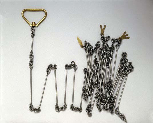
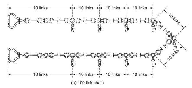
The Gunter’s Chain is a device that was first introduced in 1620 and was used to survey not only the British Empire, but also the wilderness and early American settlements. The Gunter’s Chain measures 66 feet in length and consists of 100 links usually marked off into groups of 10 by brass rings or tags. Though this device has become obsolete, it’s use has left an imprint on our nation’s history and how property has been measured and divided. The chain, the link, and the rod have all became statutory units of measurement that were made convenient by the Gunter’s Chain.
1 chain = 66 feet
1 link = 0.66 feet or 7.92 inches
1 rod = ¼ chain or 16.5 feet
1 furlong = 10 chains or 660 feet
1 mile = 80 chains or 5,280 feet
1 acre = 10 square chains or 43,560 square feet
 |  |  |